|
|
 |
|  |
|
|
|
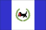 Alarsky District of Irkutsk region was found in 1922 year. The Buryat-Mongolian Autonomous Region was formed on the basis of the Aginsky Aimak according to the resolution of the Presidium of VTsIK (All-Russian Central Executive Committee) in 1922, January 9th. The District was 85 years in 2007 from the date of the foundation. Alarsky District of Irkutsk region was found in 1922 year. The Buryat-Mongolian Autonomous Region was formed on the basis of the Aginsky Aimak according to the resolution of the Presidium of VTsIK (All-Russian Central Executive Committee) in 1922, January 9th. The District was 85 years in 2007 from the date of the foundation.
Municipal District, the Alarsky District of Irkutsk region, is located in the south part of Irkutsk region. To the south, the territory is bordered by the Cheremkhovo District of Irkutsk region, to the north-west, by the Zalarinsky District of Irkutsk region , to the north, by the Nukutsky District of Irkutsk region and to the east along Angara river bank, by the Bohansky District of Irkutsk region.
The territory of the Alarsky District is 2 700 square km. Standard residential population is more 25 800 inhabitants. As of 2008, January 1st .
 Map of Irkutsk Region Map of Irkutsk Region
 For more details in English, please, add comments and we'll try to answer as soon as possible. For more details in English, please, add comments and we'll try to answer as soon as possible.
|
|
|
|
|
 Alzamai is a town of Nizhneudinsk city subordination. Alzamai is a town of Nizhneudinsk city subordination.
Foundation of Alzamai: in 1899, incorporated in 1955.
Geographic Coordinates of Alzamai: 55° 35' N., 98°34' E, located in the Eastern Sayan Mountains, on the Toporok River in the basin of the Angara River.
Zone Standard Time: MSD (Moscow Daylight Time) +5 hours
Total Area of Alzamai: 45 km2.
Population of Alzamai: 13 000 (1959); 9 000 (1989); 8 800 (1998); 7 200 (2006).
Renamings: no.
 Map of Irkutsk Region Map of Irkutsk Region
 For more details in English, please, add comments and we'll try to answer as soon as possible. For more details in English, please, add comments and we'll try to answer as soon as possible.
|
|
|
|
|
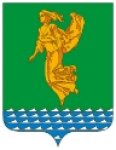 Angarsk is a city of region subordination and the centre of the Angarsky District of Irkutsk Region. Angarsk is a city of region subordination and the centre of the Angarsky District of Irkutsk Region.
Foundation of Angarsk: in 1948, city status in 1951.
2 city zones, subordinate settlement: Kitoy.
Geographic Coordinates of Angarsk: 52°34′N 103°49′E; ; located on the Irkutsk-Cheremkhovo Plain, near the inflow of the Kitoy River into the Angara River.
Zone Standard Time: MSD (Moscow Daylight Time) +5 hours
Total Area of Angarsk: 209 km2.
Population of Angarsk: 134 400 (1959); 265 800 (1989); 266 400 (1999); 245 700 (2006).
Renamings: no.
 Map of Irkutsk Region Map of Irkutsk Region
 For more details in English, please, add comments and we'll try to answer as soon as possible. For more details in English, please, add comments and we'll try to answer as soon as possible.
|
|
|
|
|
 Angarsky District of Irkutsk Region is located in the most economically developed south-western part of Irkutsk Region. The district comprises Angarsk, a city of oregion subordinance, Meget, an urban-type settlement, and also Odinsk and Savvateevka, rural settlements. Angarsky District of Irkutsk Region is located in the most economically developed south-western part of Irkutsk Region. The district comprises Angarsk, a city of oregion subordinance, Meget, an urban-type settlement, and also Odinsk and Savvateevka, rural settlements.
History of Angarsk began in 1945 year when project site of Coal-to-Liquids Plant which coal was mined in Cheremkhovsky District was established in the interfluve area of Angara and Kitoy rivers. Pioneer builders came in wild taiga, on the shore of Kitoy river, in autumn of the same year. And the worker's settlement had already been granted the status of the city named Angarsk.
Decree of the Supreme Soviet of the USSR “On the Award of the Order of the Red Banner of Labour to Angarsk City of Irkutsk Region for Success in Five-Year Plan of Development of Industry” was issued in 1971, 18th January.
 Map of Irkutsk Region Map of Irkutsk Region
 For more details in English, please, add comments and we'll try to answer as soon as possible. For more details in English, please, add comments and we'll try to answer as soon as possible.
|
|
|
|
|
 Municipal unit, Balagansky District of Irkutsk Region, is located in the central part of Irkutsk Region out of the main ways.The Balagansky District of Irkutsk Region is relatively underpopulated and economically insignificant on a scale of Irkutsk Region. The distance from Balagansk settlement, the district centre, to the nearest railway sation Zalari is 86 km and to Irkutsk is 281 km. Municipal unit, Balagansky District of Irkutsk Region, is located in the central part of Irkutsk Region out of the main ways.The Balagansky District of Irkutsk Region is relatively underpopulated and economically insignificant on a scale of Irkutsk Region. The distance from Balagansk settlement, the district centre, to the nearest railway sation Zalari is 86 km and to Irkutsk is 281 km.
The Balagansky District of Irkutsk Region has old history. But after flooding of the Bratsk Reservoir the Balagansky District was eliminated in 1962 and its territory was merged in the Ust-Udinsky District of Irkutsk Region and the Zalarinsky District of Irkutsk Region. The Balagansky District of Irkutsk Region was recreated in 1989. In 2000 the Charter of the municipal unit of the Balagansky District of Irkutsk Region was adopted.
 Map of Irkutsk Region Map of Irkutsk Region
 For more details in English, please, add comments and we'll try to answer as soon as possible. For more details in English, please, add comments and we'll try to answer as soon as possible.
|
|
|
|
|
 Characteristics of Bayandayevsky District of Irkutsk Region Characteristics of Bayandayevsky District of Irkutsk Region
According to the Decree of the Presidium of the Supreme Soviet of the RSFSR from April, 19th, 1941 the Bayandayevsky Aimak with the centre Bayandai Settlement was found on the basis of nine Rural Soviets of the Ekhirit-Bulagatsky Aimak
For the years of its existence the Bayandayevsky District of Irkutsk Region had changed many times. It had been a part of the Ekhirit-Bulagatsky District of Irkutsk Region for 11 and more years. It became a separate district in 1975, February, again.
The Bayandayevsky District is located in the north-eastern part of the Okrug within the watershed of two enormous river systems - the Yenisey and Lena and spreads along the Yakutsky Trakt on the territory of 375 619 hectares at length of 100 km and width of 40 km. The centre of the District is Bayandai settlement, the distance to Ust-Ordynsky settlement, the centre of Ust-Orda Buryat Okrug, is 62 km, to the Region Centre, Irkutsk, is 130 km. It is connected with the regional centre by a asphalt highway.
 Map of Irkutsk Region Map of Irkutsk Region
 For more details in English, please, add comments and we'll try to answer as soon as possible. For more details in English, please, add comments and we'll try to answer as soon as possible.
|
|
|
|
|
 Geographical Setting of Bodaybinsky District of Irkutsk Region Geographical Setting of Bodaybinsky District of Irkutsk Region
The Bodaybinsky District of Irkutsk Region is located on the Vitim–Patom Highland in the north-eastern part of Irkutsk Region. The District borders on Yakutia in the north and north-east, , on the Republic of Buryatia and Chita Region in the south and south-east, on the Mamsko-Chuysky District of Irkutsk Region in the west.
Total area is 91975 km2. Population of the Bodaybinsky District is 24 500 inhabitants as of 01.01.2009.
Administrative centre of the Bodaybinsky District is the city of Bodaybo which population is 15 000 inhabitants.
 Map of Irkutsk Region Map of Irkutsk Region
 For more details in English, please, add comments and we'll try to answer as soon as possible. For more details in English, please, add comments and we'll try to answer as soon as possible.
|
|
|
|
|
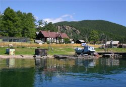 In Bolshie Koty (“Big Cats”) settlement there is the Lake Baikal Museum and the Biology Institute Aquarium. The Lake Baikal Museum was founded by Professor M.M. Kozhov. There are more than 400 various exhibits, a great collection of Baikal insects: bugs, butterflies and dragonflies. There is also a permanent scientific station, where students from Siberia do their summer practical works. Bolshoe Koty settlement is small and getting used for suburban life (for dachas), old houses pre-empted by urban residents for summer rest on the shore of Lake Baikal. In Bolshie Koty (“Big Cats”) settlement there is the Lake Baikal Museum and the Biology Institute Aquarium. The Lake Baikal Museum was founded by Professor M.M. Kozhov. There are more than 400 various exhibits, a great collection of Baikal insects: bugs, butterflies and dragonflies. There is also a permanent scientific station, where students from Siberia do their summer practical works. Bolshoe Koty settlement is small and getting used for suburban life (for dachas), old houses pre-empted by urban residents for summer rest on the shore of Lake Baikal.
The abandoned gold-bearing placer of merchant Patushinsky is located some kilometers from Bolshie Koty settlement in front of the Skriper Rock, not far from the shore of Lake Baikal, in in Sennaya Pad (Russian word for “lowland”). There are many vertical mines with a flank drift which are still preserved in a good condition, where it is possible to get down. Along the stream gap the wooden chutes of the gold-miners are still met. People stroke gold not only in river sands and gravels but also on the shore of Lake Baikal. Gravels near the estuaries of the Bolshie Koty and Malye Koty Rivers were mined from the bottom of Lake Baikal, from a float in summer and from an ice-hole in winter.
 Map of Irkutsk Region Map of Irkutsk Region
 For more details in English, please, add comments and we'll try to answer as soon as possible. For more details in English, please, add comments and we'll try to answer as soon as possible.
|
|
|
|
|
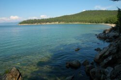 The Bolshoy Goloustny Cape deeply pushes out into Lake Baikal. Captains prefer to keep the distance from the shore because of frequent winds, storms and shallow waters. The Bolshoy Goloustny Cape deeply pushes out into Lake Baikal. Captains prefer to keep the distance from the shore because of frequent winds, storms and shallow waters.
The estuary of the river is bogged up and it is better not to go the path which is close to Lake Baikal.
Wintering place was build in the seventeenth century in the Goloustny Cape. The name “Goloustny” is characterized the place and means a steppe, treeless, bare estuary of the river which was formally called Idin-Gol. The river derived its name from the cape. Now the river is also named the Goloustnaya River. The population of Bolshoe Goloustnoe settlement is more than 600 inhabitants. The river length is 125 km.
There is a Recreation Centre represented by Buryat yurtas on the upstream side from the Shantuysky Bridge, 6-7 km from the shore of Lake Baikal.
 Map of Irkutsk Region Map of Irkutsk Region
 For more details in English, please, add comments and we'll try to answer as soon as possible. For more details in English, please, add comments and we'll try to answer as soon as possible.
|
|
|
|
|
 The Bratsky district executive committee of Irkutsk Region was firstly mentioned in documents of twenties as the Bratsky Volost Executive Committee of the Workers and Peasants Deputies Council. The last zoning of Siberian Krai was carried out in October of 1925 by the Resolution of All-Russian Central Executive Committee (VTsIK0 of the USSR of May 25, 1925. Official birthdate of the Bratsky District of Irkutsk Region is considered to be June 28, 1925). The Bratsky district executive committee of Irkutsk Region was firstly mentioned in documents of twenties as the Bratsky Volost Executive Committee of the Workers and Peasants Deputies Council. The last zoning of Siberian Krai was carried out in October of 1925 by the Resolution of All-Russian Central Executive Committee (VTsIK0 of the USSR of May 25, 1925. Official birthdate of the Bratsky District of Irkutsk Region is considered to be June 28, 1925).
The Bratsky District of Irkutsk Region in 1926 was a taiga skirt of East-Siberian Krai and a permanent place for deportations which area was about 30 000 km2 and population was about 20 000 inhabitants. There wasn’t either small- scale or large-scale industry (except for artisan workshop) at that time. 25% population was illiterate. There were 5 reading rooms, 33 propaganda rooms which were called "Krasny Ugolok", a library, 2 portable projectors and a wired-radio outlet. 1170 types of newspapers and 690 types of magazines were taken in.
Climate of the district is strongly continental, winter is long and dry and summer is short.
 Map of Irkutsk Region Map of Irkutsk Region
 For more details in English, please, add comments and we'll try to answer as soon as possible. For more details in English, please, add comments and we'll try to answer as soon as possible.
|
|
|
|
|
 Cheremkhovo is a town of region subordination and the centre of the Cheremkhovsky District of Irkutsk Region. Cheremkhovo is a town of region subordination and the centre of the Cheremkhovsky District of Irkutsk Region.
Foundation of Cheremkhovo: in 1772, town status in 1917.
Town of Subordination: Svirsk.
Geographic Coordinates of Cheremkhovo: 53°13′N 103°02′E; located on the Irkutsk-Cheremkhovo Plain.
Zone Standard Time: MSD (Moscow Daylight Time) +5 hours
Total Area of Cheremkhovo: 117 km2.
Population of Cheremkhovo: 56 000 (1939); 121 700 (1959); 73 600 (1989); 70 500 (1998); 55 600(2006).
Renamings: no.
 Map of Irkutsk Region Map of Irkutsk Region
 For more details in English, please, add comments and we'll try to answer as soon as possible. For more details in English, please, add comments and we'll try to answer as soon as possible.
|
|
|
|
|
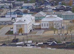 In Elantsy settlement of Irkutsk Region 4148 people live. There is the management office of the Malomorsky Block of the Pribaikalsky National Park on Lake Baikal. In Elantsy settlement of Irkutsk Region 4148 people live. There is the management office of the Malomorsky Block of the Pribaikalsky National Park on Lake Baikal.
The summer crossing gate on the exit of Elantsy is put and the Pribaikalsky National Park charges entrance fee. There is the final opportunity for a fill-up, there is no fuel filling station on the shore of the Maloe More Strait. You can see three symbolically-rendered posts “serge” tied cloths on 85 km above the bridge across the Angara River.
 Map of Irkutsk Region Map of Irkutsk Region
 For more details in English, please, add comments and we'll try to answer as soon as possible. For more details in English, please, add comments and we'll try to answer as soon as possible.
|
|
|
|
|
 Rabochee is an outskirts of Irkutsk. In 1799 the Worker’s or Craft House was opened near the Sarafanovka River and over the Ushakovka River. There were built different handicraft manufactures around the Worker’s House. As a result, the worker’s settlement was appeared near manufactures. The settlement had been named as the Borisoglebskaya Sloboda (Quarter) after Saint Boris and Gleb for a while. Growing worker’s population gave the name of this district: Rabochee (Worker’s) outskirts. Rabochee is an outskirts of Irkutsk. In 1799 the Worker’s or Craft House was opened near the Sarafanovka River and over the Ushakovka River. There were built different handicraft manufactures around the Worker’s House. As a result, the worker’s settlement was appeared near manufactures. The settlement had been named as the Borisoglebskaya Sloboda (Quarter) after Saint Boris and Gleb for a while. Growing worker’s population gave the name of this district: Rabochee (Worker’s) outskirts.
Rassokha is an urban-type settlement of subordination of Shelikhov. This settlement is located in a “rassokha” (in Siberian dialect), a conjunction of the Big Olkhinka and the Small Olkhinka Rivers, tributaries of the Irkut River.
Rytyi is a cape in the north-west of lake Baikal. The name came from the last century. This word means “delve”. There is, indeed, a very deep underwater depression between shore mountains and the Akademichesky submerged ridge.
Paberega is villages of the Tulunsky District of Irkutsk Region on the shores of the Oka River, the Iya River and others. It comes from Russian word “pabereg” (an offshore coastal strip which crops out at medium or low water level).
 For more details in English, please, add comments and we'll try to answer as soon as possible. For more details in English, please, add comments and we'll try to answer as soon as possible.
|
|
|
|
|
 Yada is a village of the Kuytunsky District of Irkutsk Region. The name derives from the Buryat word “yadaa or yaduu” which means “poor, weak”. There is the legend of local Russians with relation to the origin of this word. “ One day a part of the Yermak Cossacks lost behind, went in circles and finally reached the shore of the Oka River. They were thin, shabby, hungry people. When they saw the river, they caught fish, cooked fish soup with salt and ate as much as one can hold. And then the Cossacks said “What a delicious meal (yada in Od Russian)”. That’s the origin of the word Yada”. But as you know this story is an entire fabrication. Yada is a village of the Kuytunsky District of Irkutsk Region. The name derives from the Buryat word “yadaa or yaduu” which means “poor, weak”. There is the legend of local Russians with relation to the origin of this word. “ One day a part of the Yermak Cossacks lost behind, went in circles and finally reached the shore of the Oka River. They were thin, shabby, hungry people. When they saw the river, they caught fish, cooked fish soup with salt and ate as much as one can hold. And then the Cossacks said “What a delicious meal (yada in Od Russian)”. That’s the origin of the word Yada”. But as you know this story is an entire fabrication.
Yalga is a stow in the Olkhonsky District of Irkutsk Region.
Yamat is an ulus (an inhabited locality type of Buryats) of the Alarsky District of Irkutsk Region. The name came from the Buryat word “yaman”( a female goat) and “yamat” (goat inhabitat).
Yandy is a stow in the Ust-Udinsky District of Irkutsk Region. “yandy” or “yandy-mi” means “quack” in Evenki, i.e. Yandy is the former place for shaman rituals. Before the creation of the Bratsk Reservoir there was Yandy settlement founded in the 17th century.
 For more details in English, please, add comments and we'll try to answer as soon as possible. For more details in English, please, add comments and we'll try to answer as soon as possible.
|
|
| | |
|


